At a glance
- Network: waymarked CAI paths (white-red flashes)
- Main path: 151, crosses the whole park from Pesaro to Gabicce
- Access from the bay: path 151d (900 m, surfaced)
- Secondary paths: 155 (to Fiorenzuola) and 156 (to Casteldimezzo)
- Best period: April-June and September-October
- Minimum kit: walking boots, water, hat
- Sunday mornings (June-September): Panoramica closed to traffic, 6-12:30
Which path to choose
| Path | Section | Length | Difficulty | Suited to |
|---|---|---|---|---|
| 151d | Panoramica → Vallugola harbour | 900 m | Easy | Everyone, families |
| 151 | Pesaro → Gabicce (full traverse) | 20 km | Hiker | Experienced walkers |
| 155 | Le Logge → Fiorenzuola di Focara | 3 km | Easy-moderate | Adults, teens |
| 156 | Case Badioli → Casteldimezzo | 5 km | Hiker | Experienced walkers |
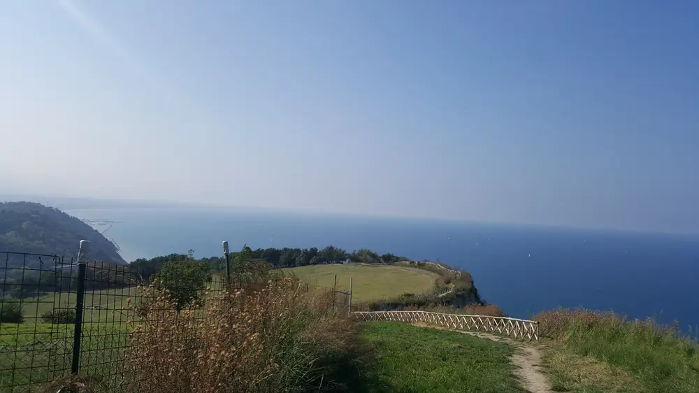
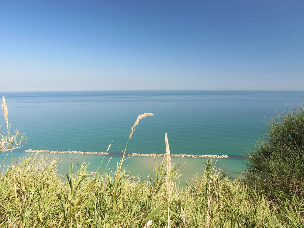
Path 151d: the bay-Panoramica link
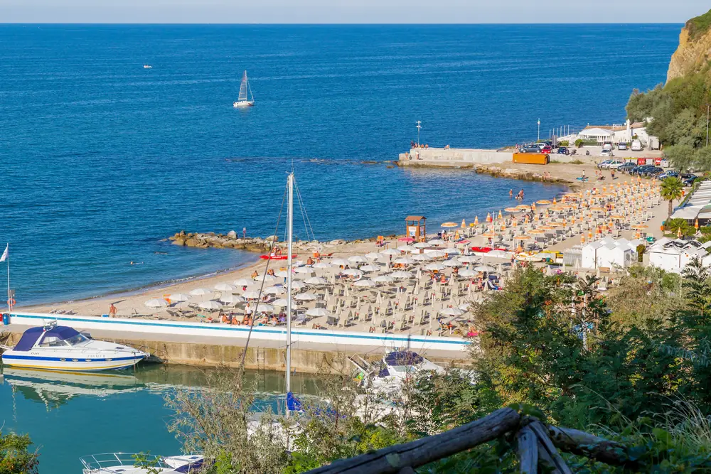
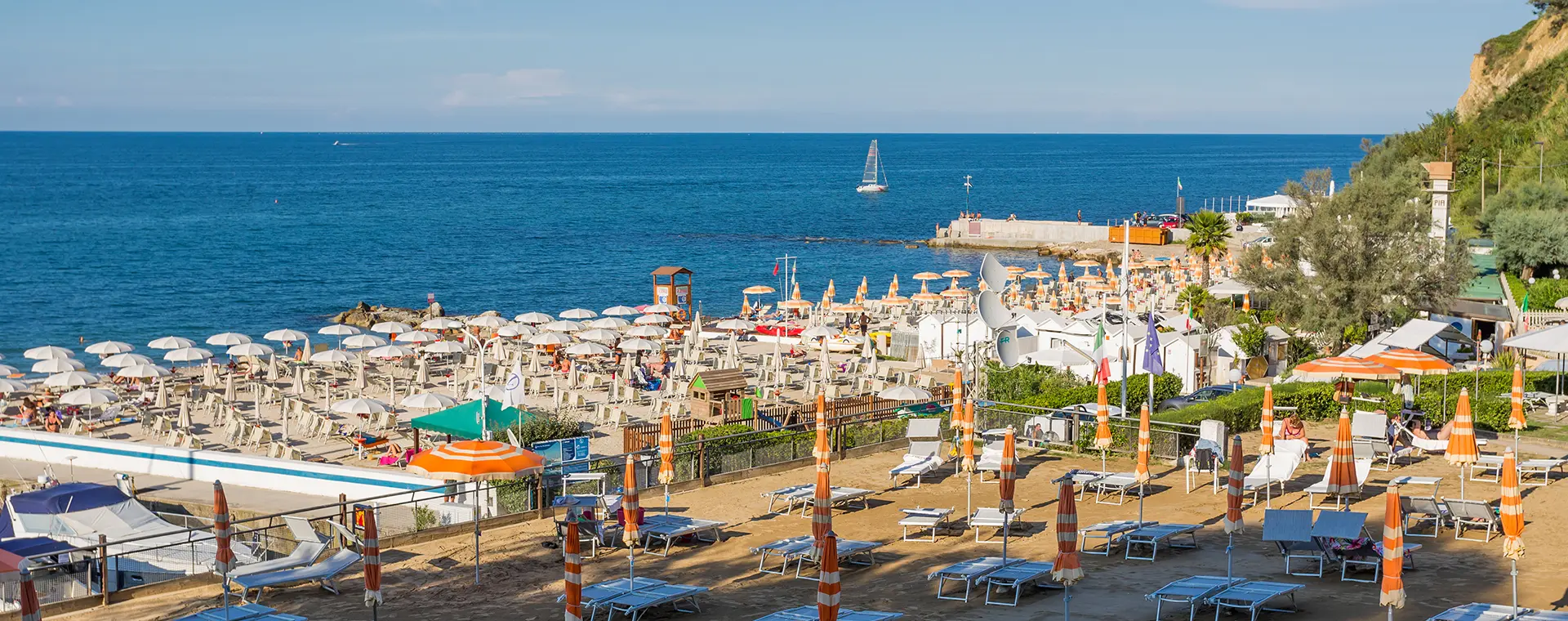
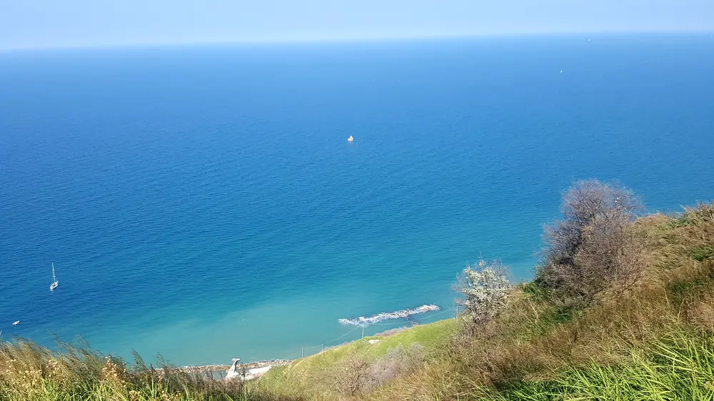
The 151d is the main link between the SP 44 Panoramica and the harbour of Vallugola. It is the most-used path in the bay.
- Length: 900 metres
- Elevation: around 150 metres descent
- Surface: surfaced for most of its length
- Time: 20 minutes down, 30 up
- Difficulty: easy, suitable for everyone
In high season it is the alternative when the harbour car park is full: you leave the car in a layby along the Panoramica and walk down.
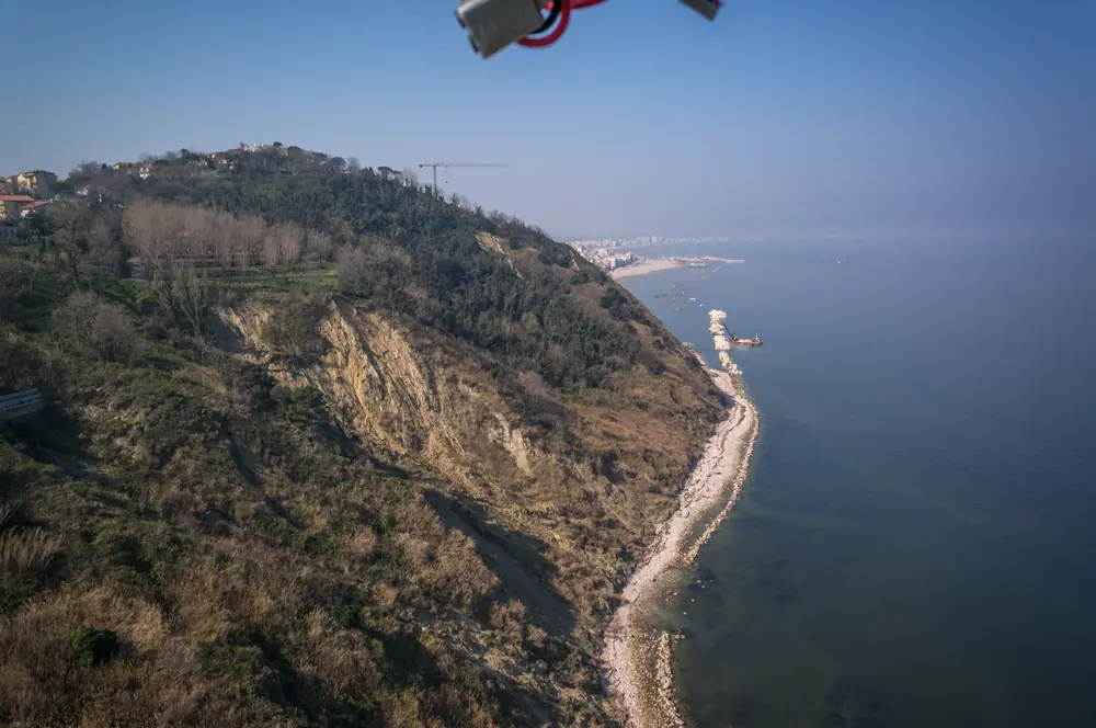
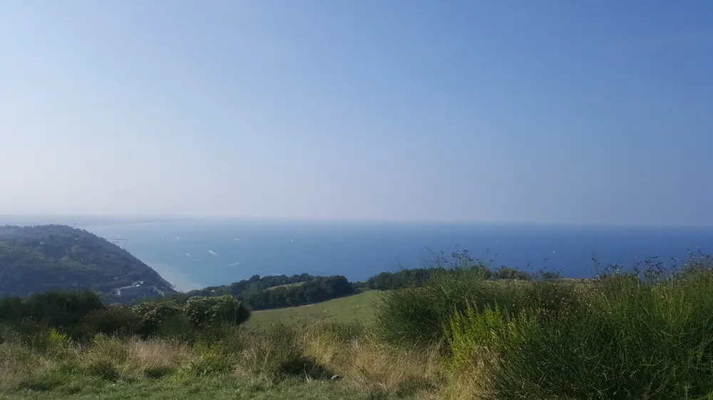
Path 151: the park traverse
The 151 is the hiking spine of the San Bartolo Park. It crosses the whole park from Pesaro to Gabicce Mare for around 20 kilometres, following the SP 44 Panoramica for much of its length and alternating with gravel tracks and ridge sections.
- Length: around 20 km
- Total elevation: repeated ascents and descents, highest point 222 m
- Time: 7-8 hours of effective walking
- Difficulty: hiking
- Logistics: not a loop, return must be arranged
The landmark stop on the route is the Montagnola (196 m), a panoramic plateau known as "the Roof of the World", from which on clear days the view reaches from Ravenna to the Conero.
The full traverse is not a loop: the return requires a second vehicle, the Pesaro-Gabicce bus service or splitting the group.
Path 155: to Fiorenzuola di Focara
The 155 drops from the Le Logge pass on the Panoramica down to Fiorenzuola di Focara, a medieval village among the Borghi più Belli d'Italia.
- Length: around 3 km
- Difficulty: easy-moderate
- Point of interest: entrance to the village with the plaque carrying Dante's lines (Canto XXVIII of the Inferno) on the Focara wind
- Possible extension: descent to the beach of Fiorenzuola from the village, via steep alleys
From Fiorenzuola you can return to the Panoramica on the same path, or build a loop via the 151.
Path 156: to Casteldimezzo
The 156 links Case Badioli to the medieval village of Casteldimezzo.
- Length: around 5 km
- Difficulty: hiker
- Mid-route stop: Colombarone, with the archaeological site of the late-Roman villa and early-medieval basilica
- Arrival: Casteldimezzo, one of the widest viewpoints in the park
Loops from Vallugola
From Vallugola you can build walking loops by combining the main paths.
Short loop: Vallugola, Gabicce Monte, Vallugola - Length: around 7 km - Elevation: 250 m - Duration: 2-3 hours - Route: up 151d, section of 151 heading north, down to the harbour
Medium loop: Vallugola, Casteldimezzo, Vallugola - Length: around 10 km - Elevation: 300 m - Duration: 3-4 hours - Route: up 151d, 151 southbound to Casteldimezzo, return on the gravel tracks via Colombarone
Long loop: Vallugola, Fiorenzuola di Focara, Vallugola - Length: around 14 km - Elevation: 400 m - Duration: 5-6 hours - Route: up 151d, 151 southbound to the Le Logge pass, down on the 155 to Fiorenzuola, return
When to go
Spring (April-June). The best season. Moderate temperatures, broom in flower in May on the ridge, raptor migration. Ideal for the longer walks and for landscape photography.
Autumn (September-October). Second optimal season. Pleasant temperatures, autumn migration, woodland colours.
Summer (July-August). Possible, but the central hours are hot and exposure on the ridge is significant. Plan walks for early morning (before 9:00) or late afternoon (after 16:30).
Winter (December-March). Paths remain walkable. The surface can be slippery after rain. Short days call for careful planning. After tramontana winds the sky is particularly clear.
What to bring
For short paths (151d) and sections near the villages: - Sports shoes or light walking boots - Water - Hat and sunscreen
For loops and the 151 traverse: - Walking boots with rubber sole - Water bottle of at least one litre per person - Hat, sunglasses, sunscreen - Windproof jacket on the ridge - Snacks or packed lunch - Charged phone, hiking map if needed
Mobile signal is generally good on paths 151 and 156, with a few shadow zones in the closer valleys of the 155.
Sunday morning on the Panoramica
From June to September, every Sunday from 6 am to 12:30 pm, the SP 44 Panoramica is closed to motor traffic and reserved for cyclists and pedestrians. It is the ideal window for those wanting to walk the ridge on the road surface, in safety and with the chance to use the full carriageway.
Accessibility
The main paths are not equipped for wheelchair travel. The San Bartolo Park periodically organises, with the CAI Montefeltro, joëlette outings from the bay to the Montagnola, in company with people with motor disabilities. These are booking-only initiatives, not a permanent service.